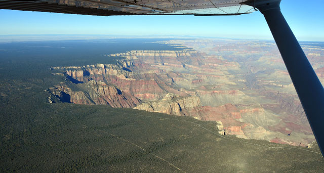
I've seen the Grand Canyon from the ground, but today's flight was the first time I've flown myself over the Canyon - and it was awe-inspiring.
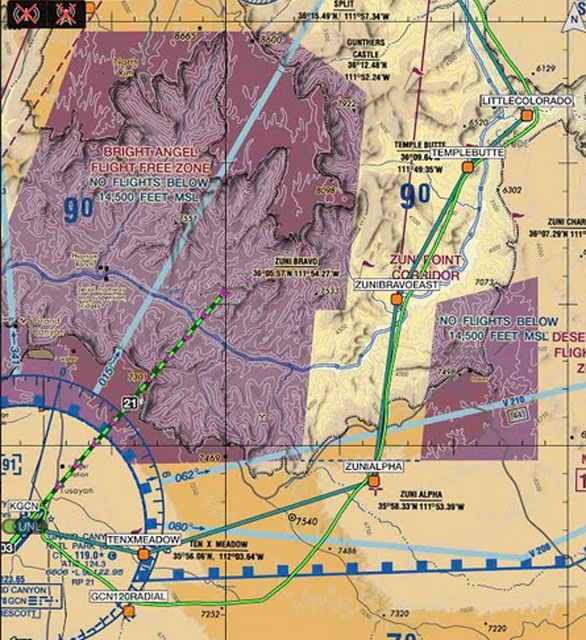
The airspace over the Grand Canyon National Park is covered in a Special Flight Rules Area (SFRA), which is designed to keep General Aviation flights like mine away from the huge number of flight tours (400+ a day), and also to keep everybody away from noise-sensitive areas. So, there are no-fly zones with corridors between them. The tour operators fly set routes and stay between 7,500 and 9,500 feet, and GA pilots are at 10,500 or 12,500 southbound and 11,500 or 13,500 northbound.
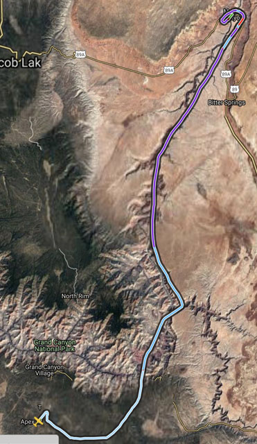
The winds at KGCN Grand Canyon Airport when I was ready to leave were rather high - 050 at 19 gusting 32 - but at least they were only a twenty-degree crosswind for Runway 3, and by 9:00 I was in the air.
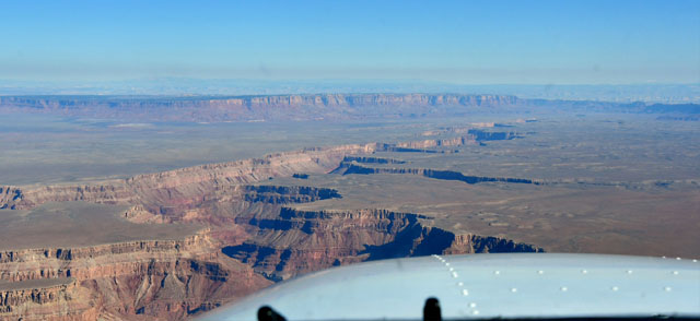
I was at 10,500 by the time I reached the edge of the SFRA south of the Zuni Corridor, and at 11,500 when I entered the corridor. KGCN is at 6,600 feet, and the plateau rises to about 7,500 where I crossed over into the SFRA. It's like flying over a flat forest and then...
The Colorado River stretches off to the horizon as you enter Zuni Corridor.
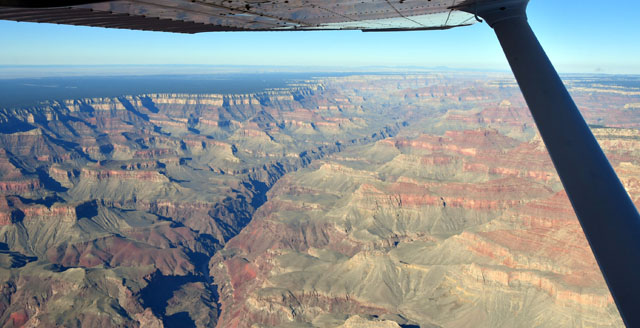
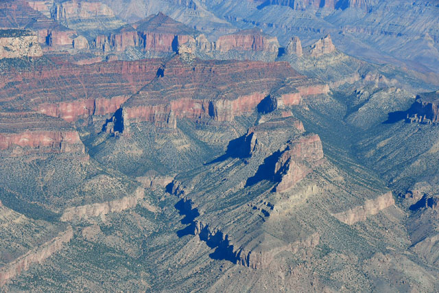
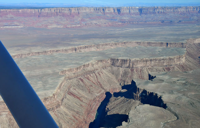
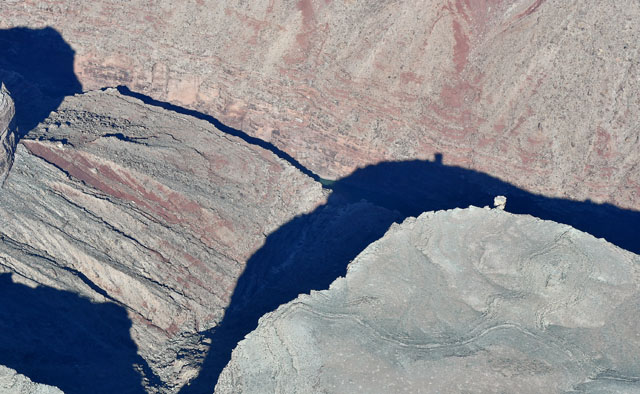
Side canyons split off from the main canyon, and flat-topped buttes are everywhere. Some of them are reporting points - all pilots in the corridors monitor the sector frequency (120.05, in this case) and announce their ID and altitude (and color/number route, for tour operators) when they hit a reporting point.
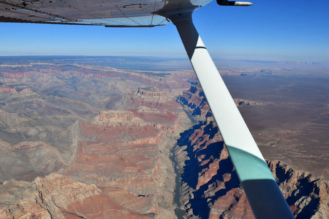
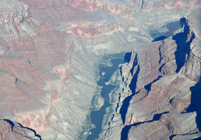
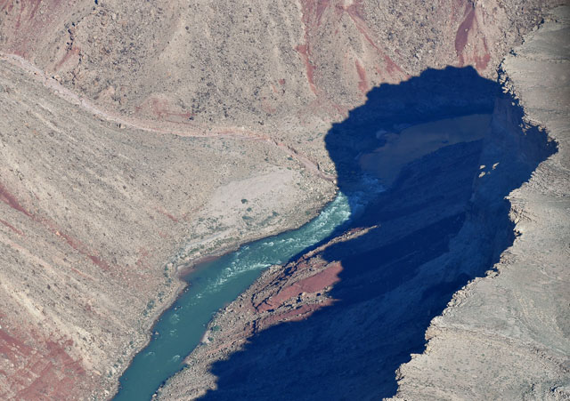
After passing through the Zuni Corridor, I followed the Colorado eastward to the confluence of the Colorado and Little Colorado rivers.
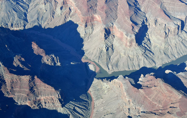
This is the confluence of the muddy Little Colorado and the clearer Colorado - the muddy water remains separate for quite a way downriver.
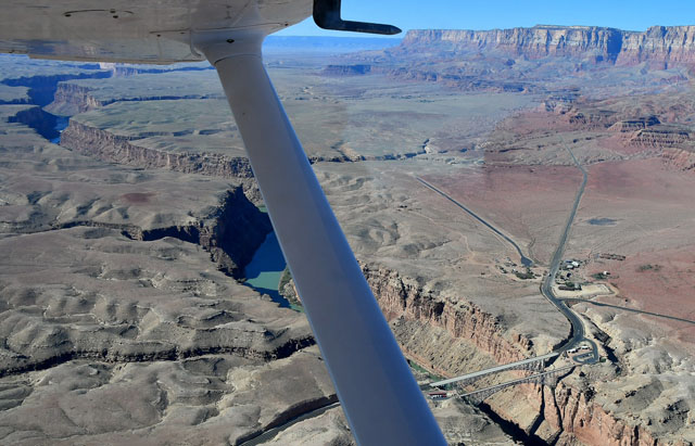
From the confluence, I followed the Colorado northward into the Marble Canyon Sector. This sector has an 8,000 foot ceiling for tour operators, so I was able to descend down to 8,500 to stay above the sector boundary.
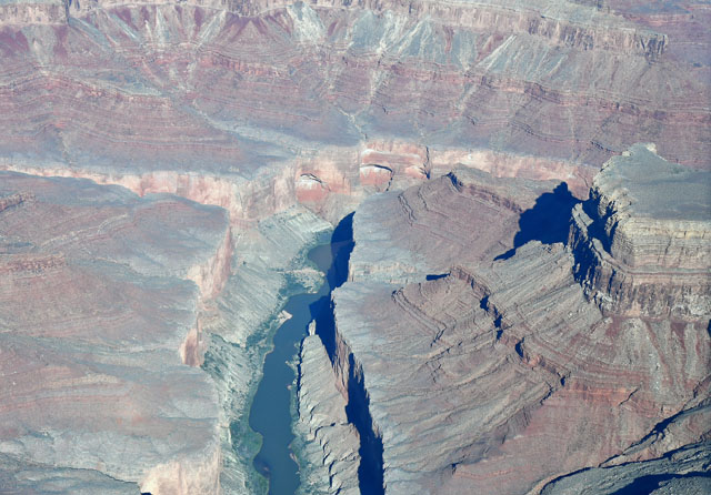
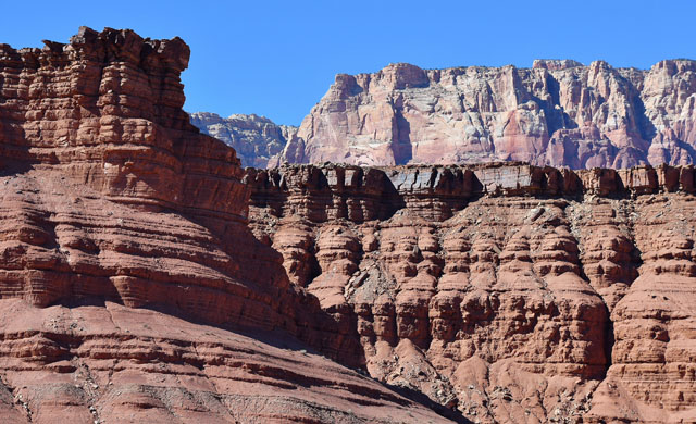
The canyon is much narrower in the Marble Canyon Sector than in the main part of the National Park to the south.
Marble Canyon Airport L41 is a 3,700 foot runway, 35 feet wide, at 3,600 feet elevation. It's located at the northern end of the Marble Canyon Sector, which poses a bit of complication, since you are only allowed to descend to the airport when you're within three miles - which means losing 5,000 feet in altitude in three miles. I flew a sort of really high upwind, descending through crosswind (picture below) down to pattern altitude by midfield downwind. The winds at L41 weren't as bad as they were at KGCN, only about 10 knots straight down runway 3.
Everything went smoothly, and less than an hour after leaving KGCN I landed at L41 Marble Canyon Airport, across the street from the Marble Canyon Lodge.
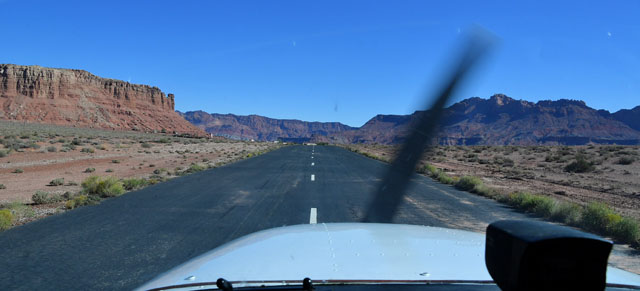
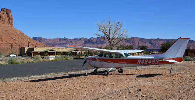
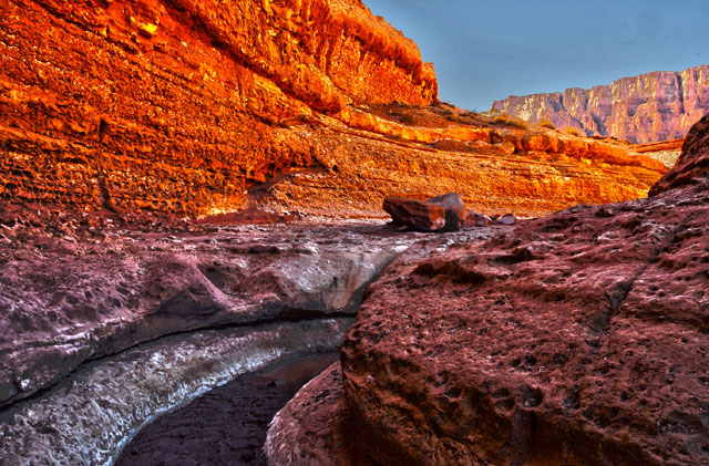
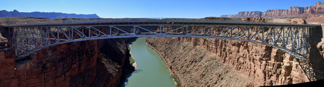
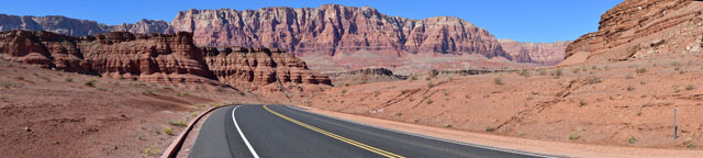
Once I'd tied down and checked in at the Lodge, I walked over to Navajo Bridge and into Marble Canyon. I'll finish this post with a few pictures from the hike.
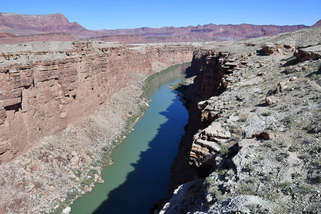
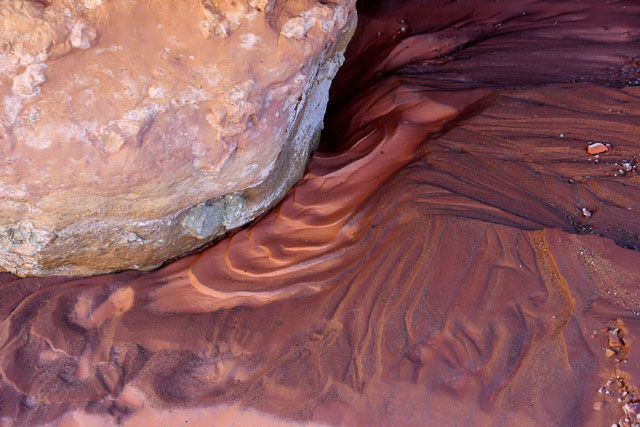
My last picture is another HDR-processed image, combined from five pictures taken at one-stop exposure intervals.